Before I begin, apologies for the stupid 'Cookies' message, this is a result of European Union legislation.
NSIDC Extent is now in the middle of the post 2007 group, having gained ground from being at the top in June.

However this hides detail that I think indicates how August will progress. Looking at the above plot of extent it would be easy to conclude that we're headed for a fairly average August, this overall view neglects conditions on a regional basis.
In the plot below triangles show conditions on 31 July 2015, the vertical bars show the historic range from 1979 to 2015 for that date, results are expressed as the difference from the long term average.

As is to be expected, no region is above average, Beaufort extent is about average, but Chukchi round to Kara are all significantly below average, and it is ice state in these regions that plays a critical role going into August.
Turning now to compactness (the ratio area/extent), Laptev Sea has average compactness, while Beaufort through to the East Siberian Sea (ESS) all show very low compactness. Note that both Barents and Kara are virtually ice free. Baffin and Hudson Bay can likely be ignored in considerations of September extent since they will probably melt out this month.

I will return to the issue of compactness and how it develops over August later in the post.
I have previously said I thought there was a good chance of seeing the Chukchi Sea ice free in July, however for the last 11 days there has been a stall in extent loss in Chukchi.

I have been unable to come up with a reasonable atmospheric explanation, and suspect that what has happened is that the ice edge retreat has stalled as multi year ice has been hit. As I have mentioned in several posts, this is also the explanation for the lack of extent loss in Beaufort.

The export of multi year ice into both Chukchi and Beaufort can be seen in ASCAT for early spring, which is shown below in a blink comparison with 2012.

This is also seen in the Drift Age Model for week 27 (latest available data).
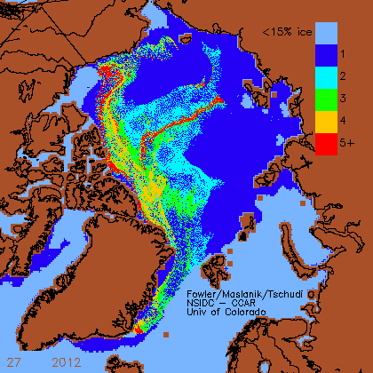
As a final comparison with 2012 I have used extracts from University of Bremen AMSR-2 maps for 31 July. The red line shows the extent on 15 September 2012. 2015 has higher concentration towards the Siberian coast than 2012 outside the red line. Concentration is lower within the 2007 extent line poleward of Beaufort and Chukchi, however the multi year ice export over winter into that region seems to have stalled Chukchi and be leading to a maintenance of extent in Beaufort.

It is for these reasons that I am very sceptical about the possibility of 2015 reaching or beating 2012. There is another reason, in a few days 2012 should start racing ahead due to the August Cyclone of 2012.
However in terms of the atmosphere, 2015 finds a revealing analogue in 2012. Data source NCEP/NCAR.

June 2012 and July 2015 were months of a dominant dipole pattern, while July 2012 and June 2015 were also very similar. If my expectation for the September minimum is correct, and August weather may prevent that, this similarity may reveal that ideal conditions for a low September extent involve a prolonged period of dipole anomaly during the June/July time around the peak of insolation (21 June, the summer solstice) .
Vector winds for July reveal a strong flow across the region from Bering Straits to the Barents Sea, the result of the dipole between low pressure over the Eurasian Arctic coast, and high pressure over the central Arctic Ocean.

The impact of the development of the dipole set up over July is clear and marked. Using anomalies of extent and area over the Peripheral Seas of the Arctic Ocean Basin (Beaufort round to Laptev), the change from the long term average seasonal cycle reveals a shift to much greater than average loss of extent and area from the 1 July. It was around this date that the dipole set up firmly developed.


This has resulted in July extent losses for the whole northern hemisphere (NSIDC Extent) being the largest on record.

For comparison, here are the losses for June.

Since 2010, as a result of the volume loss of that year, June losses have been historically high. Despite warmer temperatures in June 2015 than in 2013 and 2014 the June extent loss this year was more typical of 1998 to 2009.
So the change in behaviour of 2015's summer happened in July with the emergence of a strong Arctic Dipole, without that factor it is hard to see how conditions would have ended up as they are now.
This then takes us to the point of understanding conditions that have set the stage for August. Now to consider conditions from now leading to the September minimum. I had said previously that my guess was that the dipole would continue, that now looks unlikely, as low pressure is taking over across the Arctic Ocean and the GFS Arctic Oscillation ensemble is showing signs of a shift to a high index Arctic Oscillation (i.e. low pressure dominance). But what may favour continued melt is actually such a shift.
The following graphic is adapted from figure 2 of Dong et al, "Critical mechanisms for the formation of extreme arctic sea-ice extent in the summers of 2007 and 1996" PDF (hat tip to Andreas T at the Sea Ice Forum). The top panel shows the downwards energy flux from sunlight (insolation), the bottom panel shows infra-red radiation from clear sky and clouds, both averaged for each month from 2000 to 2010.

What is clear is that by August the energy from sunlight is declining strongly, while downwelling infra-red is still near peak summer levels. This means that for maximum melt one needs cloudy skies with strong downwelling infra-red, not clear skies, clear skies will increase net heat loss by letting more heat out of the atmosphere (to space). However the behaviour of compactness suggests that the main loss of ice through August is not driven by radiative processes but is driven by melt from the ice edge.

Taking Arctic Ocean compactness, through May, June, July compactness falls, compactness being the ratio of area and extent. Falling compactness means that area is decreasing faster than extent, this means that there is thinning within the sea ice pack behind the ice edge. What drives the general decline in compactness through the summer is the absorption of sunlight (and infra-red) within the ice pack behind the ice edge.
By August, as suggested by the graphic above from Dong et al, the sunlight falls off, and sunlight and infra-red mainly offsets the loss of heat by radiation from the sea ice. So radiative melt behind the ice edge largely stalls and the melt of the ice edge takes over. This is why after about the first week of August compactness ceases to fall, then rises as extent retreats faster than the loss of area behind the ice edge. A major factor behind this is is that the seas that have warmed as open water develops through June and July continue to melt ice at the ice edge.
This year through July the open water around the pack has warmed, Neven gives a comparison with 2012 in his recent post Late Momentum.

So how low can this year go?
For the purpose of voting in a poll at the sea ice forum I have outlined a chain of reasoning here. In qualitative terms my expectation is that 2015 September NSIDC Extent will secure a place in the lowest four years, and that as a consequence my SIPN prediction for this year is likely to overshoot*. However I consider it very unlikely that 2012 will be beaten, and equally a repeat of the last two year's increased extent is very unlikely. A caveat here is that I may have underestimated the 'stalling' potential of multi-year ice in Chukch and Beaufort.
Later this week PIOMAS data will be released, with that data it should be possible to see how much of the volume gain of the last two years will have been destroyed by this summer. What will count for that is the Central Arctic, particularly off the Canadian Arctic Archipelago, because the volume increase was predominantly due to ice over 3.3m thick for the PIOMAS gice sub grid thickness distribution in this region as shown in May.
21 comments:
Thanks for the analysis, Chris.
Later this week PIOMAS data will be released, with that data it should be possible to see how much of the volume gain of the last two years will have been destroyed by this summer.
What do you expect the data will show, Chris?
I've just posted a comment on the ASIF, wherein I compare past July's weather conditions with those of 2007 and 2009, the biggest July volume droppers in the 2006-2014 period, and it's clear that July 2015 was the warmest and sunniest on record, so I'm expecting a drop of at least 6500 km3.
With 'on record' I mean the 2006-2014 period.
Chris,
Second to third lowest sounds about right. Just out of curiosity, when do you see it going ice free in the summer? My guess would be around 2030 or so, in line with Serreze.
Neven,
Sumo wrestling fan?
No, I like how the little boy doesn't stand a chance, but goes for it anyway.
Neven,
I don't think we can lose the volume gain of 2013/14 this year, here's why, let me know if you can follow this...
Ask away if I haven't explained myself well enough....
All figures in thousand cubic km. Volumes are for the Central Arctic region.
OK, so Sept 2010 was
4.296
Sept 2014 was
6.330
So by Sept 2014 we were
2.034 above the 2010 baseline after the 2010 volume loss event.
What could we get to this year based on the post 2007 behaviour?
To get a feel I work out the month to month losses from 2007 to 2014, then calculate each as an anomaly from the average 2007 to 2014 losses for each month...
e.g. MJ = May to June loss of volume as a difference from the average.
YEAR MJ JJ JA AS
2007 0.172 0.103 -0.276 -0.143
2008 0.060 0.152 0.122 -0.072
2009 0.124 0.062 0.024 -0.017
2010 -0.130 -0.282 0.207 0.106
2011 -0.283 -0.426 -0.130 0.092
2012 -0.253 -0.328 -0.329 -0.159
2013 0.110 0.076 0.189 0.209
2014 0.200 0.643 0.193 -0.016
2015 -0.210
Notice that after 2010 losses intensify...
Here are the stats for 2007 to 2014.
Avg -0.744 -2.259 -2.106 -0.786
Stdev 0.194 0.343 0.218 0.128
Max 0.200 0.643 0.207 0.209
Min -0.283 -0.426 -0.329 -0.159
Sum of minimum JJ to AS losses gives us the largest possible loss by combining the largest losses in the post 2010 period.
-0.914
plus actual MJ loss for 2015 gives
-1.124
plus sum of average MJ to AS, gives the actual loss
-7.020
Add that to the May 2015 volume (12.093)
5.073
So that is what we could be at by September with maximum losses in the Central Arctic this year
2014 Sept volume was...
6.330
So that is...
1.257
drop in one year.
And sept 2010 was
4.296
So we'd still be...
0.777
Above the Sept 2010 september volume
So I don't think we can see the volume gain of 2013/14 disappear in one year. 2010 was the greatest year to year september volume loss (1995 and 1993 were similar), 2010 loss was -2.587. In 2010 a strong Beaufort Gyre flushed a lot of ice into Beaufort/Chukchi/ESS (BCE region), where it was severely reduced that summer.
This winter we have not seen such an export.
http://2.bp.blogspot.com/-nwVG3Oh1QIA/VUpPYcFE7dI/AAAAAAAAB3E/NUoBpiGlSuM/s1600/Arctic%2BBasin.png
Compare Peripheral ice above 3.3m in 2015 and 2010, the large pulse of that ice was what happened in 2010.
Now at around 2k km^3 the loss in 2010 was similar to the volume gain from 2010 to 2014 (Septembers), so losing this in one season is feasible. But the precedent seems to be by export from the central Arctic into either the BCE region or the Fram Strait over winter, not summer loss.
I think it will take another year or two to get back to where we were in 2010, let alone getting down to the 2012 September minimum. Unless we have another event like 1993,1995 or 2010 over winter - that's either strong export into BCE region or through Fram Strait.
Dreesen,
Late 2020's at the earliest.
Neven,
Sorry, those tables have lost the formatting, hope you can still follow me.
Sorry, those tables have lost the formatting, hope you can still follow me.
Yes, sort of. So, statistically speaking volume may end up lower than 2013. So much for the rebound.
Well, if you assume maximum losses over the 2007 to 2014 period.
I'm really not sure what July has lost, either in the Central Arctic or the periphery. To get severely deplete of that volume increase we need strong losses, which we might get.
Rebound? Uptick! ...in a downwards trend.
Neven,
Whatever happened to those methane flux graphs Viddaloo used to do on the forum? Those graphs were pretty useful.
I doubt if Neven will see that, you're best of asking at Neven's blog, or at the forum, or if you have his email via that.
Blogspot sends follow-up comments through.
dreesen, those graphs extended Viddaloo's stay somewhat (I always appreciate it when someone makes an effort). But I had to ban Viddaloo at some point.
Neven,
Is there someone else who can do them?
Chris,
Do you remember that Kara Sea study from Portnov that came out late last year?
Dreessen,
No, I missed it.
Is there more than this EGU presentation abstract?
http://meetingorganizer.copernicus.org/EGU2015/EGU2015-4838.pdf
Chris,
It more or less fits that, but I would like to get your thoughts on this:
https://cage.uit.no/news/methane-leaking-permafrost-seal-offshore-siberia/
Dreessen,
Sorry but I will have to pass on that.
I'll post again tomorrow night on PIOMAS gice. But I've just taken delivery of a PicoScope 2206A, 50MHz oscilloscope that runs from my laptop. So I'm going to be otherwise engaged.
New toys! Whoo Hoo! :)
Alright, I'm sure he seems to think gradual release over time.
Neven,
I was interested to know your thoughts on Eadhams saying there was a 50% chance of a methane bomb. He didn't explain the specifics on that, and I tend to think he's off on this one. I hope so anyway
I don't have any thoughts on methane, except that Arctic sea ice loss leads to increased atmospheric methane concentrations, among other things.
That's already bad. No need for a methane bomb.
So not likely?
Not in the short-term, I think(/hope).
Cross fingers on that one (otherwise SRM)
Post a Comment