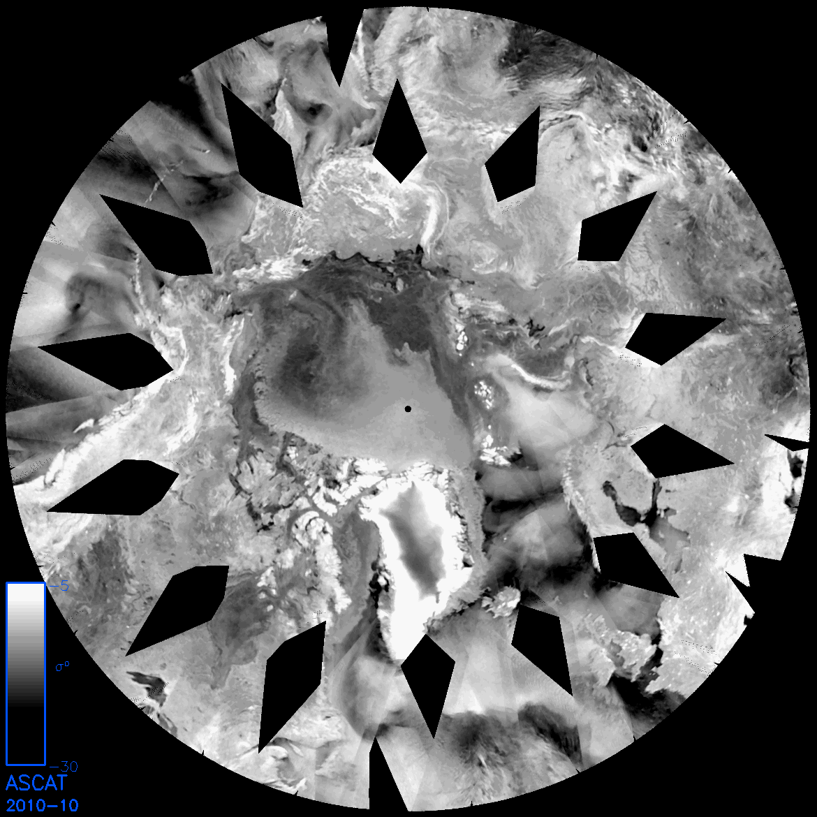
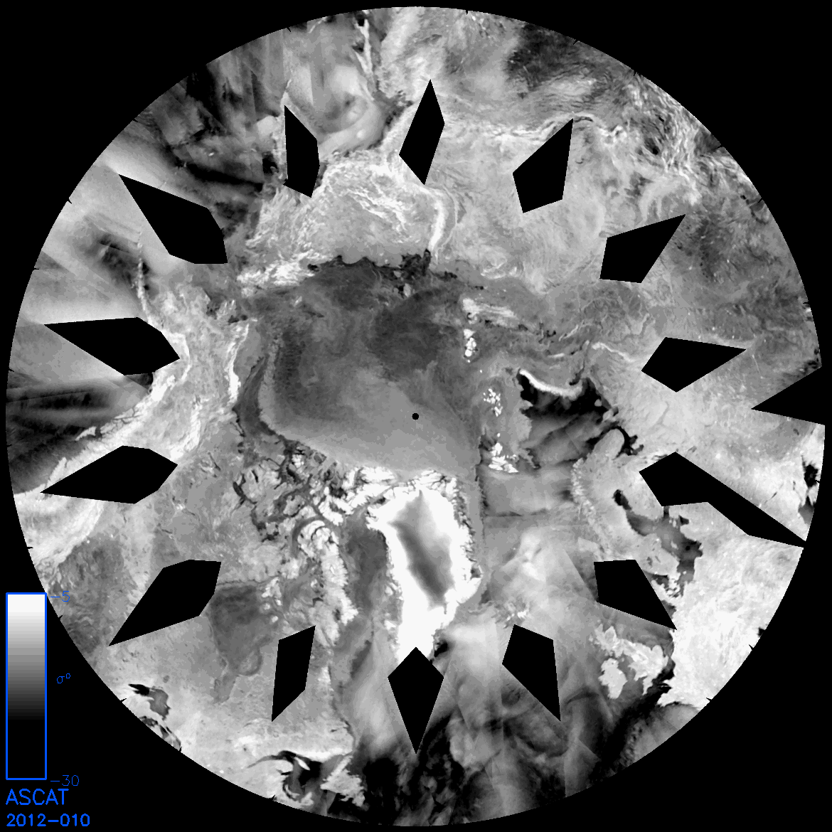
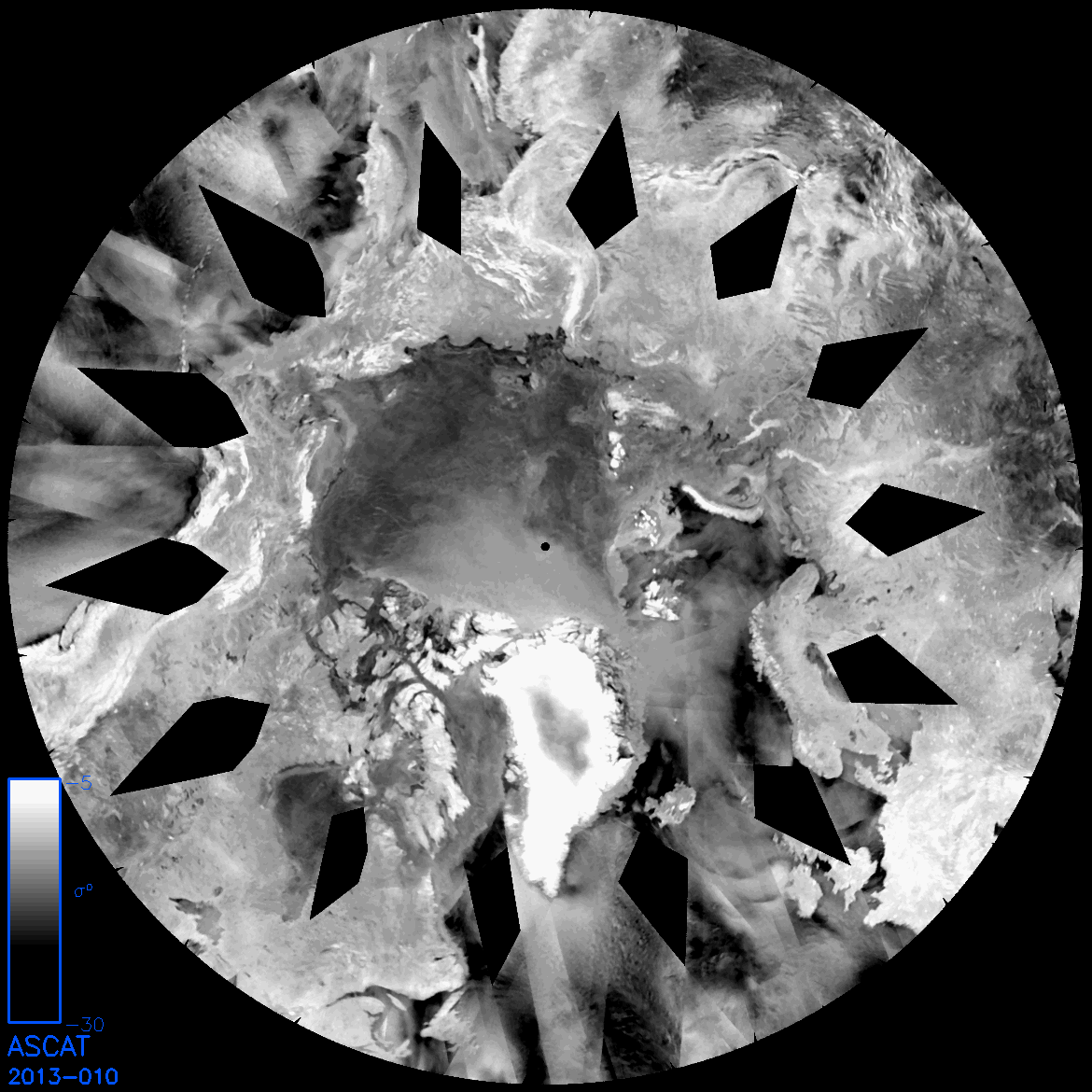
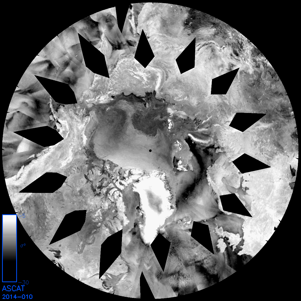
An extremely useful tool for winter sea ice watching is ASCAT, the advanced scatterometer. I think it's worth looking at some years of ASCAT for the same day as this is instructive concerning current sea ice state.
ASCAT is essentially a satellite borne radar, due to the band of radio frequencies used ASCAT is able, in winter, to discriminate between multi-year sea ice (MYI) and first year sea ice (FYI). Multi year ice being ice that has survived more than one season, first year ice being ice that has grown since the preceding minimum, the two types of ice have different dielectric constants because as ice ages brine pockets within the ice drain, this difference affects the radar backscatter.
ASCAT images are available from here. The system that preceded ASCAT was QuikScat, images for QuikScat are available here, processed images of MYI/FYI sea ice areas are available here. QuikScat can be considered in the same way as ASCAT for the purposes of assessing MYI/FYI regions.
All images are for day 10 of the respective year. Images have had contrast and brightness changed to highlight the MYI region. In the image below (day 10 of 2010) the MYI region is the bright region around the pole (black dot) and along the coasts of Greenland and the Canadian Arctic Archipelago. This is a common interpretation for the other years presented.
2010
2011
2012
2013, note the relatively small region of MYI (bright region below and left/right of pole, compared to previous years.
2014, note the substantial increase of MYI within the Arctic Ocean with respect to 2012.
Doesn't tell us anything we didn't know, but it's always useful to check observations. I'm still anticipating 2014's melt season to be rather boring, only unusual weather will get us an exciting crash and new record low this year.


No comments:
Post a Comment