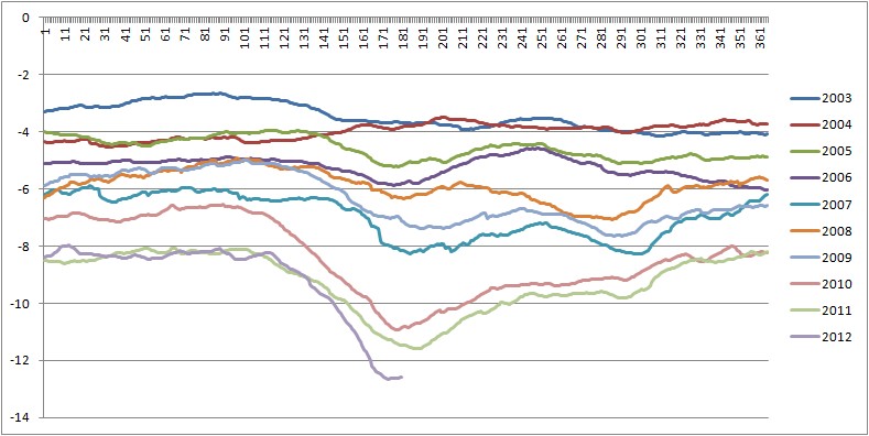
In 2007 the Arctic lost a quarter of it's September minimum area, leading to a new record minimum, this was matched last year. Looking at the state of the Arctic sea ice at present I think we're likely to have another massive loss and soundly break 2007's record. Any earlier in the year and I'd be very sceptical of claims that ice conditions could tell us anything about the state at minima, indeed I have stated my scepticism about the long term impact of thin ice over the Barents Sea during Spring. That thinning was connected to the Pethoukhov/Semenov pattern cold Winter snap in February this year, see
here. Yet the ice edge is Barents is now no different from, for example, 2011. But large scale persistent patterns of low concentration this time of year do have an impact on the coming minimum ice state.
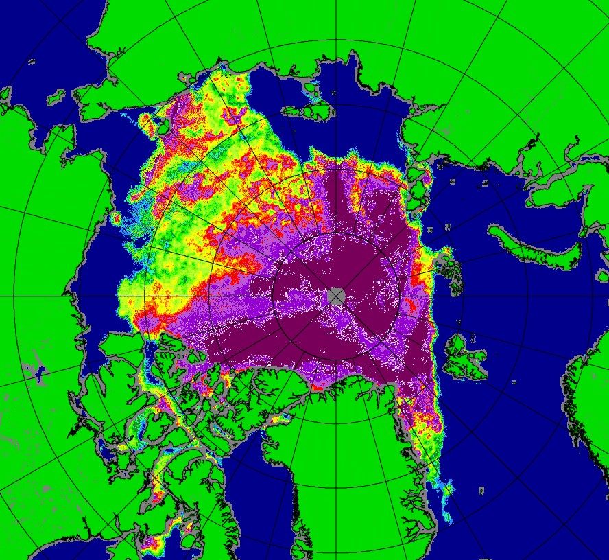
At present much of the area between Beaufort and the Siberian coast is showing very low concentrations. This image is from Bremen's
SSMIS site for 27/7/12. This is not just a few days of fleeting low anomaly, it is persistent, and in my view very likely real.