The storm in question can be seen in the following image from Wetterzentrale, in the lower centre of the plot the southerly isobars are seen to be compacted against a high to the south (geopotential height is in colours, the centre of the storm is pink). The system underwent a rapid drop in central pressure, which the media are calling a Weather Bomb, similar to the event that inspired the film "A Perfect Storm" (how does that only rate 3 stars on IMDB?).
Anyway, for awesome-natural-spectacle nuts like me, aside from the weather sites, there is an NOAA site that is of use. NOAA National Buoy Data Centre. I've been sneaking views of that all day on my phone.
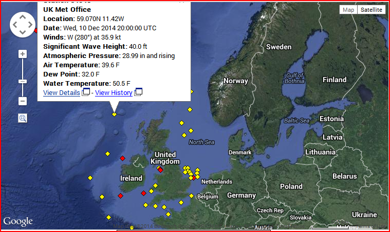
In particular there is the buoy indicated on this screenshot from the above site.
Last night I went to bed as wave height was rising. By the time I got to work wave height had topped 52 feet (almost 16 metres).
When there are very real monsters like that in the world's oceans I just do not understand why someone thinks sailing them is a good idea.


2 comments:
The smallish high pressure area over the Laptev Sea is also interesting.
Oale,
There's still a ridge there now. Is there something I'm missing, I'm not aware of potential significance or whether it's a new feature.
Intrigued...
Post a Comment